
Waterbeck topographic map
Interactive map
Click on the map to display elevation.
About this map
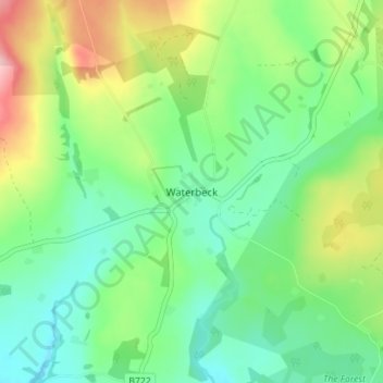
Name: Waterbeck topographic map, elevation, terrain.
Average elevation: 128 m
Minimum elevation: 72 m
Maximum elevation: 243 m
Other topographic maps
Click on a map to view its topography, its elevation and its terrain.
Stranraer
Royaume-Uni > Écosse > Dumfries and Galloway
Stranraer, Dumfries and Galloway, Écosse, DG9 7RT, Royaume-Uni
Average elevation: 45 m