
Mitte topographic map
Interactive map
Click on the map to display elevation.
About this map
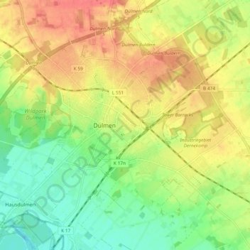
Name: Mitte topographic map, elevation, terrain.
Average elevation: 69 m
Minimum elevation: 42 m
Maximum elevation: 96 m
Other topographic maps
Click on a map to view its topography, its elevation and its terrain.
Hausdülmen
Allemagne > Rhénanie-du-Nord-Westphalie > Dülmen
Hausdülmen, Dülmen, Kreis Coesfeld, Regierungsbezirk Münster, Rhénanie-du-Nord-Westphalie, Allemagne
Average elevation: 50 m