
Thank you for supporting this site ❤️
Make a donation
Make a donation
Ban Han topographic map
Click on the map to display elevation.
Thank you for supporting this site ❤️
Make a donation
Make a donation
About this map
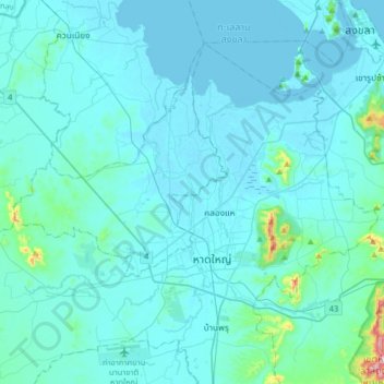
Name: Ban Han topographic map, elevation, terrain.
Location: Ban Han, Bang Klam, Songkhla Province, 90110, Thailand (6.90240 100.29209 7.22240 100.61209)
Average elevation: 31 m
Minimum elevation: -2 m
Maximum elevation: 479 m
Thank you for supporting this site ❤️
Make a donation
Make a donation