
Thank you for supporting this site ❤️
Make a donation
Make a donation
Marrigunta topographic map
Click on the map to display elevation.
Thank you for supporting this site ❤️
Make a donation
Make a donation
About this map
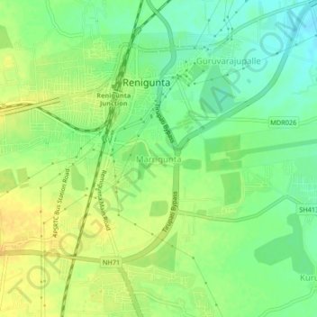
Name: Marrigunta topographic map, elevation, terrain.
Location: Marrigunta, Renigunta, Tirupati, Andhra Pradesh, 517520, India (13.60876 79.49210 13.64876 79.53210)
Average elevation: 112 m
Minimum elevation: 97 m
Maximum elevation: 126 m
Thank you for supporting this site ❤️
Make a donation
Make a donation
Other topographic maps
Click on a map to view its topography, its elevation and its terrain.