
Rzeszów topographic map
Interactive map
Click on the map to display elevation.
About this map
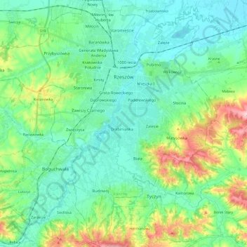
Name: Rzeszów topographic map, elevation, terrain.
Location: Rzeszów, Subcarpathian Voivodeship, Poland (49.93258 21.85868 50.08467 22.09415)
Average elevation: 239 m
Minimum elevation: 190 m
Maximum elevation: 389 m
Other topographic maps
Click on a map to view its topography, its elevation and its terrain.
Town Centre
Poland > Subcarpathian Voivodeship > Rzeszów
Town Centre, Rzeszów, Subcarpathian Voivodeship, Poland
Average elevation: 207 m