
Lelystad topographic map
Interactive map
Click on the map to display elevation.
About this map
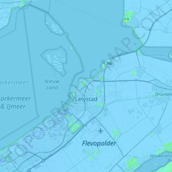
Name: Lelystad topographic map, elevation, terrain.
Location: Lelystad, Flevoland, Niederlande (52.38438 5.07459 52.69284 5.60587)
Average elevation: -2 m
Minimum elevation: -9 m
Maximum elevation: 11 m
Other topographic maps
Click on a map to view its topography, its elevation and its terrain.