
Thank you for supporting this site ❤️
Make a donation
Make a donation
Harads topographic map
Click on the map to display elevation.
Thank you for supporting this site ❤️
Make a donation
Make a donation
About this map
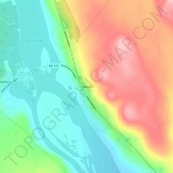
Name: Harads topographic map, elevation, terrain.
Location: Harads, Bodens kommun, Norrbotten County, 961 78, Sweden (66.06771 20.93254 66.10771 20.97254)
Average elevation: 65 m
Minimum elevation: 6 m
Maximum elevation: 152 m
Thank you for supporting this site ❤️
Make a donation
Make a donation
Other topographic maps
Click on a map to view its topography, its elevation and its terrain.