
Le Haougara topographic map
Interactive map
Click on the map to display elevation.
About this map
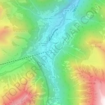
Name: Le Haougara topographic map, elevation, terrain.
Average elevation: 1,405 m
Minimum elevation: 826 m
Maximum elevation: 2,392 m
Other topographic maps
Click on a map to view its topography, its elevation and its terrain.
Lac de Gaube
France > Occitanie > Hautes-Pyrénées > Cauterets
Lac de Gaube, Cauterets, Argelès-Gazost, Hautes-Pyrénées, Occitanie, France métropolitaine, 65110, France
Average elevation: 2,079 m