
Jenig topographic map
Interactive map
Click on the map to display elevation.
About this map
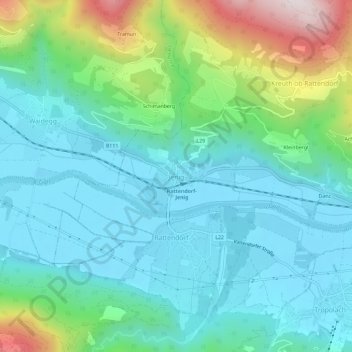
Name: Jenig topographic map, elevation, terrain.
Average elevation: 769 m
Minimum elevation: 590 m
Maximum elevation: 1,358 m
Other topographic maps
Click on a map to view its topography, its elevation and its terrain.
Pressegger See
Oostenrijk > Karinthië > Bezirk Hermagor > Hermagor-Pressegger See > Presseggersee > Paßriach
Pressegger See, Paßriach, Presseggersee, Hermagor-Pressegger See, Bezirk Hermagor, Karinthië, 9620, Oostenrijk
Average elevation: 627 m