
太安乡 topographic map
Interactive map
Click on the map to display elevation.
About this map
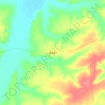
Name: 太安乡 topographic map, elevation, terrain.
Location: 太安乡, 长春市, 吉林省, 130000, 中国 (44.97476 126.45438 45.05476 126.53438)
Average elevation: 189 m
Minimum elevation: 161 m
Maximum elevation: 230 m
Other topographic maps
Click on a map to view its topography, its elevation and its terrain.
南岭1932 长春水文化生态园
南岭1932 长春水文化生态园, 鸿城街道, 南关区, 长春市, 吉林省, 130000, 中国
Average elevation: 216 m