
Thank you for supporting this site ❤️
Make a donation
Make a donation
Zephyr Cove topographic map
Click on the map to display elevation.
Thank you for supporting this site ❤️
Make a donation
Make a donation
About this map
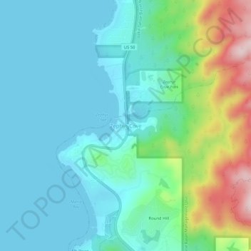
Name: Zephyr Cove topographic map, elevation, terrain.
Location: Zephyr Cove, Douglas County, Nevada, 89448, United States (38.98601 -119.96724 39.02601 -119.92724)
Average elevation: 1,978 m
Minimum elevation: 1,897 m
Maximum elevation: 2,254 m
Thank you for supporting this site ❤️
Make a donation
Make a donation
Other topographic maps
Click on a map to view its topography, its elevation and its terrain.