
Thank you for supporting this site ❤️
Make a donation
Make a donation
Winnsboro topographic map
Click on the map to display elevation.
Thank you for supporting this site ❤️
Make a donation
Make a donation
About this map
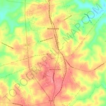
Name: Winnsboro topographic map, elevation, terrain.
Location: Winnsboro, Fairfield County, South Carolina, United States (34.34486 -81.10912 34.39381 -81.07051)
Average elevation: 152 m
Minimum elevation: 103 m
Maximum elevation: 183 m
Thank you for supporting this site ❤️
Make a donation
Make a donation
Other topographic maps
Click on a map to view its topography, its elevation and its terrain.