
Thank you for supporting this site ❤️
Make a donation
Make a donation
Gluggarnir topographic map
Click on the map to display elevation.
Thank you for supporting this site ❤️
Make a donation
Make a donation
About this map
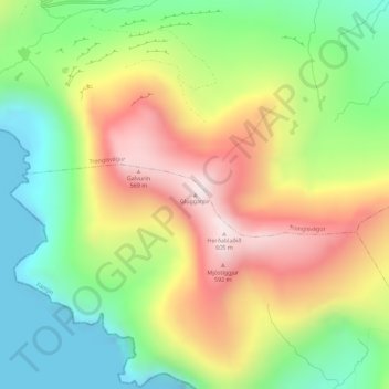
Name: Gluggarnir topographic map, elevation, terrain.
Location: Gluggarnir, Fámjin, Suðuroyar sýsla, 870, Færøerne (61.54623 -6.89306 61.54633 -6.89296)
Average elevation: 266 m
Minimum elevation: -7 m
Maximum elevation: 602 m
Thank you for supporting this site ❤️
Make a donation
Make a donation