
Thank you for supporting this site ❤️
Make a donation
Make a donation
Lambaklettur topographic map
Click on the map to display elevation.
Thank you for supporting this site ❤️
Make a donation
Make a donation
About this map
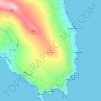
Name: Lambaklettur topographic map, elevation, terrain.
Location: Lambaklettur, Sumba, Suðuroyar sýsla, 970, Færøerne (61.40484 -6.68692 61.40494 -6.68682)
Average elevation: 84 m
Minimum elevation: -14 m
Maximum elevation: 315 m
Thank you for supporting this site ❤️
Make a donation
Make a donation