
Thank you for supporting this site ❤️
Make a donation
Make a donation
Myrkjanoyrarfjall topographic map
Click on the map to display elevation.
Thank you for supporting this site ❤️
Make a donation
Make a donation
About this map
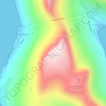
Name: Myrkjanoyrarfjall topographic map, elevation, terrain.
Location: Myrkjanoyrarfjall, Klaksvik, Norðoya sýsla, 700, Færøerne (62.24791 -6.56265 62.24801 -6.56255)
Average elevation: 272 m
Minimum elevation: 0 m
Maximum elevation: 691 m
Thank you for supporting this site ❤️
Make a donation
Make a donation