
Thank you for supporting this site ❤️
Make a donation
Make a donation
Hvannafelli topographic map
Click on the map to display elevation.
Thank you for supporting this site ❤️
Make a donation
Make a donation
About this map
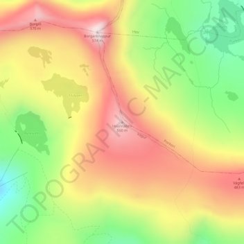
Name: Hvannafelli topographic map, elevation, terrain.
Location: Hvannafelli, Vágur, Suðuroyar sýsla, 900, Færøerne (61.49347 -6.83959 61.49357 -6.83949)
Average elevation: 330 m
Minimum elevation: 72 m
Maximum elevation: 569 m
Thank you for supporting this site ❤️
Make a donation
Make a donation