
Quero topographic map
Interactive map
Click on the map to display elevation.
About this map
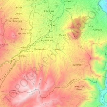
Name: Quero topographic map, elevation, terrain.
Location: Quero, Tungurahua, Ecuador (-1.50838 -78.72649 -1.35229 -78.53791)
Average elevation: 3,335 m
Minimum elevation: 2,172 m
Maximum elevation: 4,407 m
Other topographic maps
Click on a map to view its topography, its elevation and its terrain.