
Illescas topographic map
Interactive map
Click on the map to display elevation.
About this map
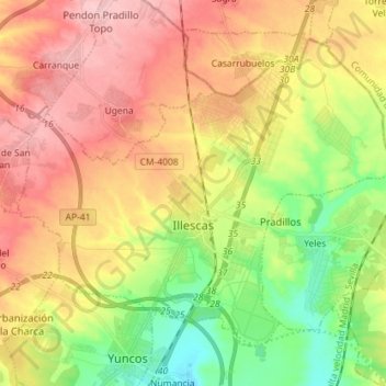
Name: Illescas topographic map, elevation, terrain.
Location: Illescas, La Sagra, Toledo, Castilla-La Mancha, 45200, España (40.09034 -3.91457 40.17749 -3.77187)
Average elevation: 602 m
Minimum elevation: 525 m
Maximum elevation: 678 m