
Thank you for supporting this site ❤️
Make a donation
Make a donation
Umueze Anam topographic map
Click on the map to display elevation.
Thank you for supporting this site ❤️
Make a donation
Make a donation
About this map
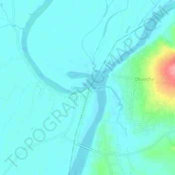
Name: Umueze Anam topographic map, elevation, terrain.
Location: Umueze Anam, Anambra West, Anambra State, Nigeria (6.31731 6.81396 6.35731 6.85396)
Average elevation: 27 m
Minimum elevation: 12 m
Maximum elevation: 113 m
Thank you for supporting this site ❤️
Make a donation
Make a donation