
Thank you for supporting this site ❤️
Make a donation
Make a donation
Escaleras topographic map
Click on the map to display elevation.
Thank you for supporting this site ❤️
Make a donation
Make a donation
About this map
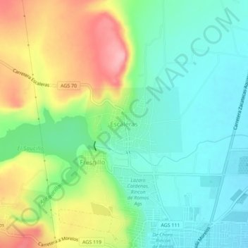
Name: Escaleras topographic map, elevation, terrain.
Location: Escaleras, Rincón de Romos, Aguascalientes, 20406, Mexico (22.23144 -102.35337 22.27144 -102.31337)
Average elevation: 1,990 m
Minimum elevation: 1,942 m
Maximum elevation: 2,077 m
Thank you for supporting this site ❤️
Make a donation
Make a donation