
Thank you for supporting this site ❤️
Make a donation
Make a donation
Calbe (Saale) topographic map
Click on the map to display elevation.
Thank you for supporting this site ❤️
Make a donation
Make a donation
About this map
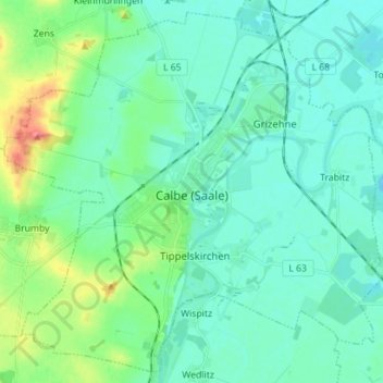
Name: Calbe (Saale) topographic map, elevation, terrain.
Location: Calbe (Saale), Salzlandkreis, Saxony-Anhalt, Germany (51.86308 11.70712 51.94465 11.84771)
Average elevation: 64 m
Minimum elevation: 49 m
Maximum elevation: 123 m
Thank you for supporting this site ❤️
Make a donation
Make a donation
Other topographic maps
Click on a map to view its topography, its elevation and its terrain.
Aschersleben
Germany > Saxony-Anhalt > Salzlandkreis > Aschersleben > Aschersleben
Average elevation: 139 m