
Thank you for supporting this site ❤️
Make a donation
Make a donation
Tangkahan Durian topographic map
Click on the map to display elevation.
Thank you for supporting this site ❤️
Make a donation
Make a donation
About this map
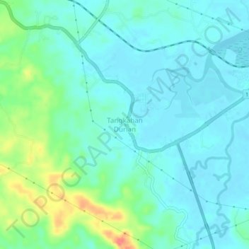
Name: Tangkahan Durian topographic map, elevation, terrain.
Location: Tangkahan Durian, Langkat, North Sumatra, Sumatra, Indonesia (3.97672 98.21249 4.01672 98.25249)
Average elevation: 15 m
Minimum elevation: 0 m
Maximum elevation: 64 m
Thank you for supporting this site ❤️
Make a donation
Make a donation