
Thank you for supporting this site ❤️
Make a donation
Make a donation
Alik topographic map
Click on the map to display elevation.
Thank you for supporting this site ❤️
Make a donation
Make a donation
About this map
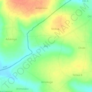
Name: Alik topographic map, elevation, terrain.
Location: Alik, Amach, Lira District, Northern Region, Uganda (2.08471 32.88530 2.12471 32.92530)
Average elevation: 1,100 m
Minimum elevation: 1,078 m
Maximum elevation: 1,123 m
Thank you for supporting this site ❤️
Make a donation
Make a donation