
Hanovre topographic map
Interactive map
Click on the map to display elevation.
About this map
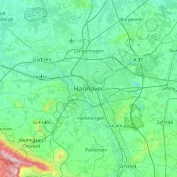
Name: Hanovre topographic map, elevation, terrain.
Location: Hanovre, Région de Hanovre, Basse-Saxe, 30159, Allemagne (52.21448 9.57855 52.53448 9.89855)
Average elevation: 70 m
Minimum elevation: 22 m
Maximum elevation: 402 m