
Thank you for supporting this site ❤️
Make a donation
Make a donation
Vertinary topographic map
Click on the map to display elevation.
Thank you for supporting this site ❤️
Make a donation
Make a donation
About this map
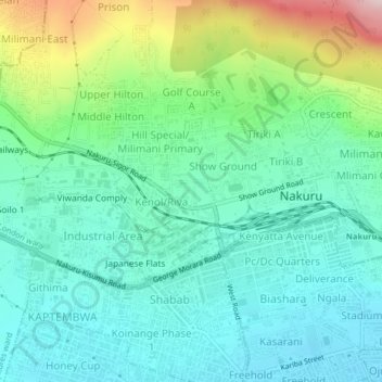
Name: Vertinary topographic map, elevation, terrain.
Location: Vertinary, London ward, Nakuru West, Nakuru, 20100, Kenya (-0.29977 36.03962 -0.25977 36.07962)
Average elevation: 1,889 m
Minimum elevation: 1,801 m
Maximum elevation: 2,138 m
Thank you for supporting this site ❤️
Make a donation
Make a donation