
Thank you for supporting this site ❤️
Make a donation
Make a donation
Camaya topographic map
Click on the map to display elevation.
Thank you for supporting this site ❤️
Make a donation
Make a donation
About this map
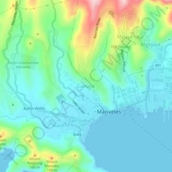
Name: Camaya topographic map, elevation, terrain.
Location: Camaya, Mariveles, Bataan, Central Luzon, 2106, Philippines (14.42159 120.46483 14.46159 120.50483)
Average elevation: 61 m
Minimum elevation: -2 m
Maximum elevation: 253 m
Thank you for supporting this site ❤️
Make a donation
Make a donation
Other topographic maps
Click on a map to view its topography, its elevation and its terrain.