
Thank you for supporting this site ❤️
Make a donation
Make a donation
Deogyang-gu topographic map
Click on the map to display elevation.
Thank you for supporting this site ❤️
Make a donation
Make a donation
About this map
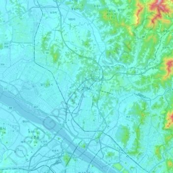
Name: Deogyang-gu topographic map, elevation, terrain.
Location: Deogyang-gu, Goyang-si, South Korea (37.57179 126.75946 37.74851 126.99427)
Average elevation: 49 m
Minimum elevation: -4 m
Maximum elevation: 568 m
Thank you for supporting this site ❤️
Make a donation
Make a donation
Other topographic maps
Click on a map to view its topography, its elevation and its terrain.