
Thank you for supporting this site ❤️
Make a donation
Make a donation
Maungakaramea topographic map
Click on the map to display elevation.
Thank you for supporting this site ❤️
Make a donation
Make a donation
About this map
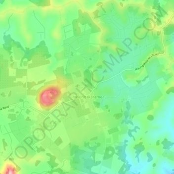
Name: Maungakaramea topographic map, elevation, terrain.
Location: Maungakaramea, Whangārei District, Northland, New Zealand (-35.86461 174.18389 -35.82461 174.22389)
Average elevation: 113 m
Minimum elevation: 44 m
Maximum elevation: 274 m
Thank you for supporting this site ❤️
Make a donation
Make a donation
Other topographic maps
Click on a map to view its topography, its elevation and its terrain.