
Thank you for supporting this site ❤️
Make a donation
Make a donation
Waregem topographic map
Click on the map to display elevation.
Thank you for supporting this site ❤️
Make a donation
Make a donation
About this map
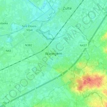
Name: Waregem topographic map, elevation, terrain.
Location: Waregem, Kortrijk, West Flanders, Flanders, 8790, Belgium (50.84682 3.39236 50.92682 3.47236)
Average elevation: 16 m
Minimum elevation: 3 m
Maximum elevation: 65 m
Thank you for supporting this site ❤️
Make a donation
Make a donation
Other topographic maps
Click on a map to view its topography, its elevation and its terrain.