
Thank you for supporting this site ❤️
Make a donation
Make a donation
Plumbon topographic map
Click on the map to display elevation.
Thank you for supporting this site ❤️
Make a donation
Make a donation
About this map
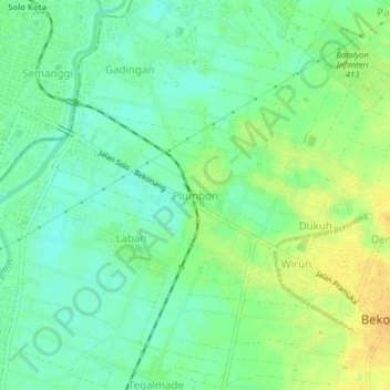
Name: Plumbon topographic map, elevation, terrain.
Location: Plumbon, Sukoharjo, Central Java, Java, 57141, Indonesia (-7.61607 110.83376 -7.57607 110.87376)
Average elevation: 93 m
Minimum elevation: 81 m
Maximum elevation: 109 m
Thank you for supporting this site ❤️
Make a donation
Make a donation
Other topographic maps
Click on a map to view its topography, its elevation and its terrain.