
Thank you for supporting this site ❤️
Make a donation
Make a donation
Loch Lomond Junction topographic map
Click on the map to display elevation.
Thank you for supporting this site ❤️
Make a donation
Make a donation
About this map
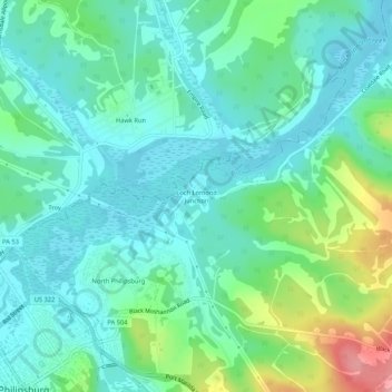
Name: Loch Lomond Junction topographic map, elevation, terrain.
Average elevation: 460 m
Minimum elevation: 426 m
Maximum elevation: 567 m
Thank you for supporting this site ❤️
Make a donation
Make a donation
Other topographic maps
Click on a map to view its topography, its elevation and its terrain.
Black Moshannon State Park
United States > Pennsylvania > Centre County > Rush Township
Black Moshannon State Park is open year-round for recreation and has an extensive network of trails which allow hiking, biking, and viewing the bog habitat at the Black Moshannon State Natural Area. The park is in a Pennsylvania Important Bird Area, where bird watchers have recorded 175 species. It is also…
Average elevation: 602 m