
Knockans North topographic map
Interactive map
Click on the map to display elevation.
About this map
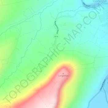
Name: Knockans North topographic map, elevation, terrain.
Average elevation: 123 m
Minimum elevation: 4 m
Maximum elevation: 381 m
Other topographic maps
Click on a map to view its topography, its elevation and its terrain.
Fauchil
Royaume-Uni > Irlande du Nord > Cushendall
Fauchil, Cushendall, County Antrim, Irlande du Nord, Royaume-Uni
Average elevation: 50 m
Grortnagross Middle
Royaume-Uni > Irlande du Nord > Cushendall
Grortnagross Middle, Cushendall, County Antrim, Irlande du Nord, Royaume-Uni
Average elevation: 153 m