
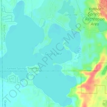
Gun Lake topographic map
Interactive map
Click on the map to display elevation.
About this map
Name: Gun Lake topographic map, elevation, terrain.
Average elevation: 234 m
Minimum elevation: 222 m
Maximum elevation: 285 m
Other topographic maps
Click on a map to view its topography, its elevation and its terrain.
Grosse Ile
États-Unis > Michigan > Grosse Ile
Grosse Ile, Grosse Ile Township, Wayne County, Michigan, 48138, États-Unis
Average elevation: 178 m
Au Sable River
Au Sable River, Au Sable Township, Iosco County, Michigan, États-Unis
Average elevation: 178 m
Ramsey Lake
Ramsey Lake, Dd Road, Nahma Township, Delta County, Michigan, États-Unis
Average elevation: 227 m
Anchor Bay
États-Unis > Michigan > New Baltimore
Anchor Bay, Taylor Street, New Baltimore, Macomb County, Michigan, 48047, États-Unis
Average elevation: 173 m