
Thank you for supporting this site ❤️
Make a donation
Make a donation
Ribera topographic map
Click on the map to display elevation.
Thank you for supporting this site ❤️
Make a donation
Make a donation
About this map
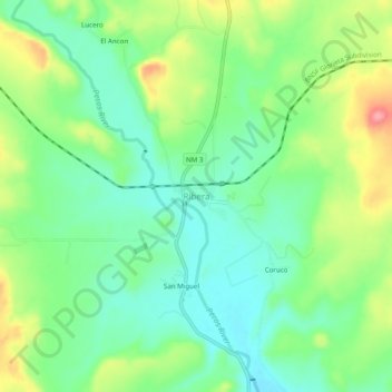
Name: Ribera topographic map, elevation, terrain.
Average elevation: 1,856 m
Minimum elevation: 1,820 m
Maximum elevation: 1,920 m
Thank you for supporting this site ❤️
Make a donation
Make a donation
Other topographic maps
Click on a map to view its topography, its elevation and its terrain.
Pecos National Historic Park
United States > New Mexico > San Miguel County > Pecos
Average elevation: 2,239 m