
Thank you for supporting this site ❤️
Make a donation
Make a donation
Aniwa topographic map
Click on the map to display elevation.
Thank you for supporting this site ❤️
Make a donation
Make a donation
About this map
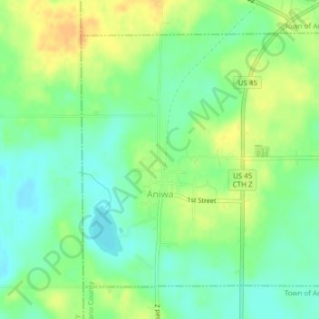
Name: Aniwa topographic map, elevation, terrain.
Location: Aniwa, Shawano County, Wisconsin, United States (45.00072 -89.22376 45.02222 -89.19408)
Average elevation: 429 m
Minimum elevation: 415 m
Maximum elevation: 446 m
Thank you for supporting this site ❤️
Make a donation
Make a donation
Other topographic maps
Click on a map to view its topography, its elevation and its terrain.