
Thank you for supporting this site ❤️
Make a donation
Make a donation
Muak Lek topographic map
Click on the map to display elevation.
Thank you for supporting this site ❤️
Make a donation
Make a donation
About this map
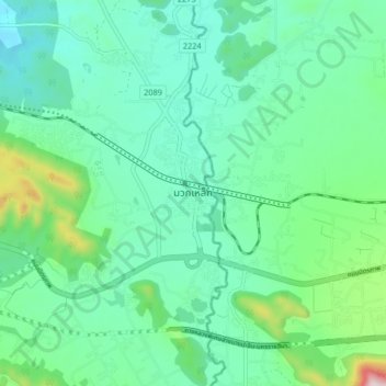
Name: Muak Lek topographic map, elevation, terrain.
Location: Muak Lek, Saraburi Province, 18180, Thailand (14.60935 101.16106 14.68935 101.24106)
Average elevation: 266 m
Minimum elevation: 136 m
Maximum elevation: 742 m
Thank you for supporting this site ❤️
Make a donation
Make a donation