
La Conterie topographic map
Interactive map
Click on the map to display elevation.
About this map
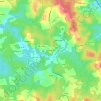
Name: La Conterie topographic map, elevation, terrain.
Average elevation: 219 m
Minimum elevation: 186 m
Maximum elevation: 265 m
Other topographic maps
Click on a map to view its topography, its elevation and its terrain.
Les Sarrazinies
France > Nouvelle-Aquitaine > Dordogne > Saint-Félix-de-Reillac-et-Mortemart
Les Sarrazinies, Saint-Félix-de-Reillac-et-Mortemart, Sarlat-la-Canéda, Dordogne, Nouvelle-Aquitaine, France métropolitaine, 24260, France
Average elevation: 217 m