Geolocate

Mount Ophir topographic map

Interactive map

Click on the map to display elevation.

About this map

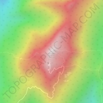
Name: Mount Ophir topographic map, elevation, terrain.

Location: Mount Ophir, Tangkak, Johor, Malaysia (2.37316 102.60784 2.37326 102.60794)

Average elevation: 840 m

Minimum elevation: 372 m

Maximum elevation: 1,223 m

Other topographic maps

Click on a map to view its topography, its elevation and its terrain.

Kulai

Malaysia > Johor

Average elevation: 40 m

Tangkak

Malaysia > Johor

Average elevation: 48 m

Kota Tinggi

Malaysia > Johor

Average elevation: 29 m

Muar

Malaysia > Johor

Average elevation: 26 m

Pulau Juling

Malaysia > Johor > Pasir Gudang

Average elevation: 2 m

Iskandar Puteri

Malaysia > Johor > Iskandar Puteri

Average elevation: 28 m

Pontian

Malaysia > Johor

Average elevation: 19 m