
Paraplui topographic map
Interactive map
Click on the map to display elevation.
About this map
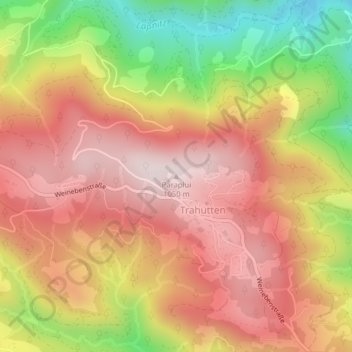
Name: Paraplui topographic map, elevation, terrain.
Average elevation: 840 m
Minimum elevation: 535 m
Maximum elevation: 1,047 m
Other topographic maps
Click on a map to view its topography, its elevation and its terrain.
Trahütten
Österreich > Steiermark > Bezirk Deutschlandsberg > Deutschlandsberg
Trahütten, Deutschlandsberg, Bezirk Deutschlandsberg, Steiermark, 8530, Österreich
Average elevation: 780 m