
Thank you for supporting this site ❤️
Make a donation
Make a donation
Thaxted topographic map
Click on the map to display elevation.
Thank you for supporting this site ❤️
Make a donation
Make a donation
About this map
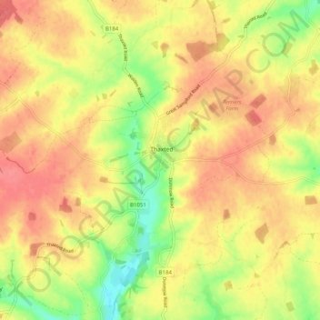
Name: Thaxted topographic map, elevation, terrain.
Location: Thaxted, Uttlesford, Essex, England, United Kingdom (51.92587 0.29587 51.97911 0.39597)
Average elevation: 99 m
Minimum elevation: 61 m
Maximum elevation: 124 m
Thank you for supporting this site ❤️
Make a donation
Make a donation
Other topographic maps
Click on a map to view its topography, its elevation and its terrain.