
Thank you for supporting this site ❤️
Make a donation
Make a donation
Etty topographic map
Click on the map to display elevation.
Thank you for supporting this site ❤️
Make a donation
Make a donation
About this map
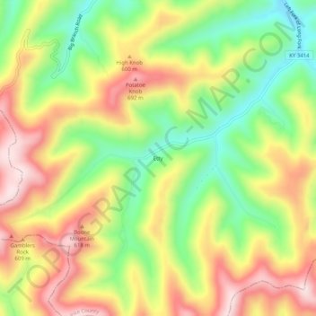
Name: Etty topographic map, elevation, terrain.
Location: Etty, Pike County, Kentucky, 41835, United States (37.23233 -82.69710 37.27233 -82.65710)
Average elevation: 513 m
Minimum elevation: 328 m
Maximum elevation: 706 m
Thank you for supporting this site ❤️
Make a donation
Make a donation
Other topographic maps
Click on a map to view its topography, its elevation and its terrain.