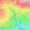
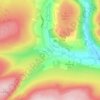
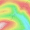
Hebden topographic map
Click on the map to display elevation.
Hebden
The name Hebden may be derived from either heope, Old English for a rose-hip or heopa, Old English for a bramble, and dene, Old English for a valley, or from the Scandinavian Hebban, a topographical description of a ridge forming an elevated site above a small valley. Two Bronze Age stone circles and remnants of huts on the moors above the village show that the area has been settled since earliest times, and a hoard of 33 silver dinari dating from 30 to 170 AD found in a local field indicates that the Romans had a presence. The hoard is now on display at the Craven Museum & Gallery. An Iron Age or Romano-British settlement has been tentatively identified on the banks of Gate Up Gill on the moors to the north-west of the village. Place names such as Scale Haw indicate the Norse left their influence. There is no documentary record of the area until a mention in the Domesday Book of 1086, in which the settlement was referred to as Hebedene held by Osbern d'Arques, of Thorpe Arch. At the time of the Conquest the land was held by Dreng, which is a Nordic name.
About this map

Name: Hebden topographic map, elevation, terrain.
Average elevation: 329 m
Minimum elevation: 149 m
Maximum elevation: 544 m
Other topographic maps
Click on a map to view its topography, its elevation and its terrain.



Beckwithshaw
United Kingdom > England > North Yorkshire > Harrogate > Beckwithshaw
Average elevation: 161 m









Bolton Castle
United Kingdom > England > North Yorkshire > Redmire > Castle Bolton
Average elevation: 250 m


Thimbleby & Osmotherly Show field
United Kingdom > England > North Yorkshire > Thimbleby
Average elevation: 152 m



Killinghall
United Kingdom > England > North Yorkshire > Harrogate > Killinghall
Average elevation: 86 m




Willerby Brow Plantation
United Kingdom > England > North Yorkshire > Ryedale > Staxton > Binnington
Average elevation: 100 m