
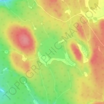
Gisborne Lake topographic map
Interactive map
Click on the map to display elevation.
About this map
Name: Gisborne Lake topographic map, elevation, terrain.
Average elevation: 1,321 m
Minimum elevation: 1,274 m
Maximum elevation: 1,357 m
Other topographic maps
Click on a map to view its topography, its elevation and its terrain.
Tunkwa Lake
Canada > British Columbia > Thompson-Nicola Regional District > Area J (Copper Desert Country)
Tunkwa Lake, Area J (Copper Desert Country), Thompson-Nicola Regional District, British Columbia, Canada
Average elevation: 1,161 m
Williams Creek
Canada > British Columbia > Thompson-Nicola Regional District > Area J (Copper Desert Country)
Williams Creek, Area J (Copper Desert Country), Thompson-Nicola Regional District, British Columbia, Canada
Average elevation: 1,100 m
Fraser Plateau
Canada > British Columbia > Thompson-Nicola Regional District > Area J (Copper Desert Country)
Fraser Plateau, Area J (Copper Desert Country), Thompson-Nicola Regional District, British Columbia, Canada
Average elevation: 1,800 m