
Thank you for supporting this site ❤️
Make a donation
Make a donation
Andosilla topographic map
Click on the map to display elevation.
Thank you for supporting this site ❤️
Make a donation
Make a donation
About this map
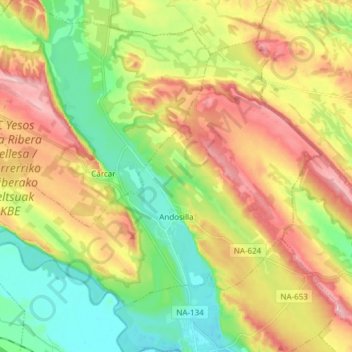
Name: Andosilla topographic map, elevation, terrain.
Location: Andosilla, Tierra Estella, 31261, España (42.34759 -2.03206 42.43323 -1.88103)
Average elevation: 369 m
Minimum elevation: 291 m
Maximum elevation: 469 m
Thank you for supporting this site ❤️
Make a donation
Make a donation
Other topographic maps
Click on a map to view its topography, its elevation and its terrain.