
Thank you for supporting this site ❤️
Make a donation
Make a donation
Saint David topographic map
Click on the map to display elevation.
Thank you for supporting this site ❤️
Make a donation
Make a donation
About this map
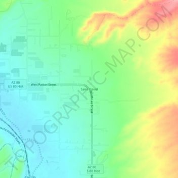
Name: Saint David topographic map, elevation, terrain.
Location: Saint David, Cochise County, Arizona, 85630, United States (31.88425 -110.23424 31.92425 -110.19424)
Average elevation: 1,138 m
Minimum elevation: 1,100 m
Maximum elevation: 1,209 m
Thank you for supporting this site ❤️
Make a donation
Make a donation
Other topographic maps
Click on a map to view its topography, its elevation and its terrain.
Thank you for supporting this site ❤️
Make a donation
Make a donation
Kartchner Caverns State Park
United States > Arizona > Cochise County > Benson
Average elevation: 1,432 m