
Thank you for supporting this site ❤️
Make a donation
Make a donation
Carson City topographic map
Click on the map to display elevation.
Thank you for supporting this site ❤️
Make a donation
Make a donation
About this map
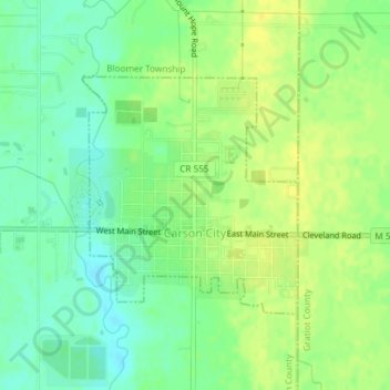
Name: Carson City topographic map, elevation, terrain.
Location: Carson City, Montcalm County, Michigan, 48811, United States (43.17132 -84.85711 43.18787 -84.83661)
Average elevation: 232 m
Minimum elevation: 220 m
Maximum elevation: 242 m
Thank you for supporting this site ❤️
Make a donation
Make a donation
Other topographic maps
Click on a map to view its topography, its elevation and its terrain.