
Boscobel topographic map
Interactive map
Click on the map to display elevation.
About this map
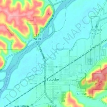
Name: Boscobel topographic map, elevation, terrain.
Location: Boscobel, Grant County, Wisconsin, États-Unis d'Amérique (43.12238 -90.72114 43.17025 -90.66006)
Average elevation: 223 m
Minimum elevation: 192 m
Maximum elevation: 326 m