
康乐镇 topographic map
Interactive map
Click on the map to display elevation.
About this map
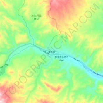
Name: 康乐镇 topographic map, elevation, terrain.
Location: 康乐镇, 肃南裕固族自治县, 张掖市, 甘肃省, 734400, 中国 (38.92558 99.87456 39.00558 99.95456)
Average elevation: 2,056 m
Minimum elevation: 1,818 m
Maximum elevation: 2,436 m
Other topographic maps
Click on a map to view its topography, its elevation and its terrain.