
Thank you for supporting this site ❤️
Make a donation
Make a donation
Benton County topographic map
Click on the map to display elevation.
Thank you for supporting this site ❤️
Make a donation
Make a donation
About this map
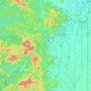
Name: Benton County topographic map, elevation, terrain.
Location: Benton County, Oregon, United States (44.27656 -123.81643 44.72130 -123.07313)
Average elevation: 209 m
Minimum elevation: 27 m
Maximum elevation: 1,227 m
Thank you for supporting this site ❤️
Make a donation
Make a donation