
Thank you for supporting this site ❤️
Make a donation
Make a donation
Whitland topographic map
Click on the map to display elevation.
Thank you for supporting this site ❤️
Make a donation
Make a donation
About this map
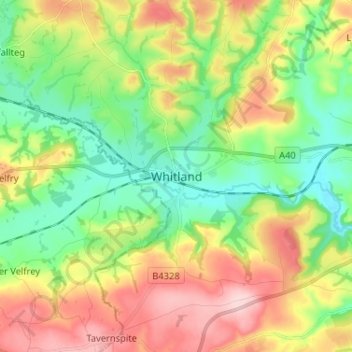
Name: Whitland topographic map, elevation, terrain.
Location: Whitland, Carmarthenshire, Wales, SA34 0AG, United Kingdom (51.77928 -4.65453 51.85928 -4.57453)
Average elevation: 86 m
Minimum elevation: 6 m
Maximum elevation: 204 m
Thank you for supporting this site ❤️
Make a donation
Make a donation